Monday, May 10, 2010

One more bridge to cross, on foot or bike | 520 - An Environmental Blog | Rochester Democrat and Chronicle

One more bridge to cross, on foot or bike | 520 - An Environmental Blog | Rochester Democrat and Chronicle


Erie Lackawanna railroad bridge!

POSTED BY SORR • APRIL 29, 2010 • 11:14 AM

The city of Rochester is now soliciting proposals for design of a new walking-biking trail on a bridge over the Genesee River near the University of Rochester.

The 1,600-foot-long stretch of trail would use the old Erie-Lackawanna Railroad bridge that crosses the river from the Plymouth-Exchange neighborhood to the university’s River Campus. It would connect with the excellent trails, much used by runners, walkers and riders, already in place on each side of the Genesee.
If I have the count right, the Erie-Lackawanna span would be the city’s seventh bridge over the river reserved for pedestrians and bikers – a most impressive number, in my view, for a city this size.
Footbridge near Brooks Avenue
How many have you sampled? There’s a spectacular high bridge (built atop a sewer pipe actually) at Seneca Park, a walkway atop a dam at the little-known Middle Falls, the Pont du Rennes at High Falls, the Sister Cities span downtown, the existing footbridge at the UR near Brooks Avenue, and a lovely little crossing at Genesee Valley Park south of Elmwood Avenue
Most if not all are connected by trails, I believe. A bike-rider could cross them all in what? An hour? Somebody try it and let me know. Send me pics.
Back to Footbridge 7 at the UR. If all goes well, the city will hold public meetings this fall, design will be done over the winter, construction will start next spring and the repurposed bridge will open in October 2011. The project will cost about $1.2 million, with the city and New York state splitting the tab.
According to this detailed feasibility study done by Environmental Design and Research for the city and the Genesee Transportation Council two years ago, the bridge was built in the early 1900s, though earlier spans stood in that spot back to the 1850s. The rail line carried passenger and freight traffic between Rochester and Avon, Livingston County, with connections to points south. Erie-Lackawanna discontinued use of the line in 1971, a year before the rail company entered bankruptcy. The bridge has been unused since, except by occasional trespassers, and is now owned by the city.
The bridge as it is now (EDR feasibility study image)
When work is done, the bedraggled span will be transformed. It will have a new deck, be partly repainted, made ADA compliant and will sport ”amenities such as railing, lighting, benches, bike racks, and landscaping,” as the request for proposals put it.
The bridge as it may be (from EDR feasibility study)
The bridge as it may be (EDR feasibility study image)
Pretty nifty, eh? It should be a nice addition to the ever-growing network of trails in our region.
Oh, and if you’re not clear where these bridges are, here’s a home-made Google map, with the trails near the planned bridge marked as well. You’ll have to find the rest of the paths yourself. Enjoy!

Here is the project schedule from the Request for Proposals:
Project Schedule  
 Start Work      June 2010
 Site Reconnaissance & Survey   June 2010 – July 2010
 Draft  Alternatives Prepared    July 2010 – August 2010
 Host Citizen Advisory Meetings   August 2010 – October 2010
 Finalize Alternatives     September 2010 – October 2010
 Host Public Meeting(s)    August 2010 – October 2010
 Preliminary Design of Selected Alternative  October 2010 - November 2010
 Final Design & Construction Documents  December 2010 – January 2011
 Bid Process/Issuance of Construction Contracts February 2011 – April 2011
 Construction Phase     May 2011
 Open Bridge      October 2011 


Monday, April 12, 2010

Lynch Woods Park in Brighton

The Lehigh Valley North Trail connects RIT, UofR, and Brighton.  Lynch Woods Park in Brighton spans the area East of the trail from Crittenden Road (to the North) and Brighton-Henrietta Town Line Road (to to the South).  

The Town of Brighton is currently planning a variety of trails and boardwalks to increase usability and access.   

Tuesday, April 6, 2010

Recent News on the PA side of the Rochester-Williamsport Greenway and the Headwaters of the Genesee River


Allen Kerkeslager reports...

The  North Central Pennsylvania Regional Planning and Development Commission, has  drafted plans for integrating Potter County into a state-wide program for developing greenways in all 67 counties in Pennsylvania.  Included in their ranking is about 40 miles of rail-trails to connect the famous Pine Creek Trail to trail systems along the Genesee River south to the NY/PA state line.  This will bring a fresh infusion of PA state, regional, and local resources to the completion of the Rochester-Williamsport Greenway. 

Most notably, regional planning commission officials have identified the number one priority for trail development in Potter County as the completion a new westward extension of the famous Pine Creek Trail to the sources of Pine Creek (west of Galeton, PA).  At its western terminus, this new Pine Creek Trail extension will connect with another new rail-trail ("the North Border Trail") that will extend southward from the NY/PA border near Genesee, PA, to the source of the east branch of the Genesee River between Ulysses and Gold, PA.  

These two trails will connect near a special site marking the triple divide that embraces the sources of the Genesee River, the Allegheny River, and the Susquehanna River (West Branch and Pine Creek).  Together these two trails will link the current trailhead of the Pine Creek Trail at Ansonia, PA, with a rail-trail in NY that follows the Genesee River south from Wellsville, NY, to the NY/PA state line (the WAG Trail, which was recently acquired by NYSDEC).

The North Central Pennsylvania Regional Planning and Development Commission will hold a public meeting to collect final comments on its draft of the trail systems in Potter County, PA, in the Gunsberger Building in Coudersport, PA, at 1:00 pm on April 15.  

For additional details about developments in the Rochester-Williamsport greenway on the PA side and updates on the Genesee River Wilds Project (www.geneseeriverwilds.org), contact Allen Kerkeslager, Saint Joseph's University, Philadelphia, at akerkesl@sju.edu or (610) 660-1121.

Wednesday, March 31, 2010

Sustainability Mobility Fair - May 8th Free expo

“Sustainability Mobility Fair - Future Transportation Choices for Short Trips"
Admission is free and open to the public.

When: Saturday, May 8, 2010 from 10:AM - 2 PM
Where: The Center for Student Innovation at RIT, 1 Lomb Memorial Dr Rochester, NY 14623-5698

Attendees will be exposed to what is new and now available on the market and able to experience the latest choices in Electric, Hydrogen, Biodiesel, Natural Gas, Propane, Hybrid, Plug-In, Ethanol, Walking School Buses, and cycling transportation technologies.

All alternative fuel options will be on display. As more commuters become aware of travel choices, we expect to see more of them regularly choosing transportation alternatives because of the benefits. Sponsored by Rochester Institute of Technology (RIT) and the Center for Environmental Information (CEI).

Sunday, February 21, 2010

Rochester-Williamsport Greenway in the Williamsport Sun Gazette


NY-PA trail blends recreation, conservation
By PATRICK DONLIN - pdonlin@sungazette.com
POSTED: February 21, 2010
Save | Print | Email


When they decided they had a common interest of creating recreational trails, two professors determined it was time to band together with one another and others to blaze a 230-mile path connecting Williamsport and Rochester, N.Y.

Jon Schull, Rochester Institute of Technology associate professor of innovation and invention, said he and Allen Kerkeslager met a couple months ago in Philadelphia, where Kerkeslager is a professor at St. Joseph's University.

"We talked about the synergy between his (Kerkeslager's) work in the Genesee Wilds Association and my work which I call the 'Rochester Greenway,' " Schull said. "We realized the two sections we had been focusing on were the two end points of this project."

Schull, one of the founders of the Rochester Cycling Alliance, is excited about the recreation possibilities.

Kerkeslager described different reasons he wants to get involved. He grew up in rural New York, near the proposed trail project, and continues to go home to see family there, driving through Williamsport on the way.

The trail project also is a chance for Kerkeslager, a religions of the ancient world professor, to delve into something he admits isn't as obscure.


'A breather ... for humanity'

"Much of this (trail project) is a breather to do stuff for humanity," he said.

It comes with a price.

Kerkeslager said the cost for the 230-mile connection could be $100 million, but he offered an explanation.

To offer it completely with trails, he expects a $50 million expense.

There would be another cost of $50 million for the water conservation measures he recommends.

It'll take time, too, as Kerkeslager said, "Twenty years, I think that's a fair estimate to be completely off-road."

Kerkeslager, who rides a bicycle 10 miles round trip on his daily work commute, said he's a proponent of the proposed cycling recreation.


Environmental improvements

But, he's also an advocate for environmental improvements possible through the trail plan.

The project spans the Susquehanna, Genesee and the headwaters of the Allegheny River, all watersheds Kerkeslager intends to protect.

Kerkeslager believes building a riparian buffer along the trail is a cost-saving conservation alternative to building expensive rock wall dams.

Greenway planning preserves forests and conserves nature, according to Rick Biery, regional planning program manager for Northern Tier Regional Planning and Development Commission.

Biery embraces plan development and the possible trail if it's conducted responsibly.

"From a concept standpoint, these things are great," Biery said. "It brings an opportunity to tap into a resource hikers and bikers may not get to go through unless we look at the possibilities."

Through connectivity, the recreational system experience improves, according to Kerkeslager.

He said it will connect the nationally renowned Pine Creek Gorge bicycle trail to the Genesee River's gorgeous waterfalls.

Jobs will be created, Kerkeslager added, especially in the sectors of tourism, hospitality, recreation and tour guiding.

He intends to bring the plan to the forefront at meetings of the Northcentral Pennsylvania Regional Planning and Development Commission in Ridgway.


Facing up to the challenge

Some consider the most challenging interstate link to be completed as a 40-mile proposed trail running northwest from Wellsboro to the New York border.

A connection just west of Wellsboro is in the conceptual stage, according to Biery.

"We're working with a consultant to develop a greenways open space outdoors recreation plan. It's an overall concept plan," he said.

Matt Marusiak, project coordinator for the Northcentral Pennsylvania Greenways and Open Space Plan, said land deals still need to be made there to acquire trail property, much of which lack old railroad beds ideal for making recreation trails.

In areas where land can't be bought, Kerkeslager said the trail may have to go along Route 6.


Railroad beds ideal

A recreational trail using a road area isn't uncommon, as Kerkeslager said portions of the Appalachian Trail he's explored are the same way.

Railroad beds like what are used in the local Pine Creek Trail are ideal, but alternatives can be used if necessary.

Kerkeslager said there's often a section here and there where planners have to route a trail along roads where landowners want to keep their property or where an area is undevelopable.

Since July, Biery's been involved in what he described as an outreach process including public meetings, contact with stakeholders, and thousands of resident surveys in the counties of Tioga, Sullivan, Wyoming and Susquehanna.

Biery hopes to reach the next goal by early June, which includes a direct recommendations document he said is drafted for review by the planning partners.

"That's where projects will come from," Biery said of further details to be unveiled.


Project offerings

Bicycle recreation is important but so is waterways enjoyment, organizers say.

Like the canoe and kayak launches already offered along the Genesee and Pine Creek rail trails, Kerkeslager plans on offering more boat launches where possible.

He hopes his entire New York to Pennsylvania circuit can be as beautiful as the Pine Creek trail residents enjoy here, but he realizes some adjustments may be necessary.

A hurdle in New York is not to have a trail, but to have it off-road.

A 20-mile section from Belfast, N.Y., to Wellsville, N.Y., can be offered as soon as this summer if it's presented on an existing country road.

"In the long run, we'd like to get these trails off the roads entirely," Kerkeslager said.

Using a combination of existing roads and trails, he said a route from Williamsport to New York could be offered later this year.

Organizers would merely have to offer maps, a Web site and post some trail sections with markers honoring the trail.

"It could say future home of (the NYPA Greenways)," Kerkeslager said, reminding it's only a working name.

"To open for usage with provisional usage on roads, we can do that as soon as it gets warm," he said.

People already bicycle from Rochester to Williamsport, according to Schull.

"They ride on trails and ride on roads when the trail peters out," he said.

It can be done now, but Lycoming County Visitors Bureau Executive Director Jason Fink doesn't suggest competing with traffic along the Route 14-15 corridors.


'A safer way'

"This would be a safer way to enjoy it," said Fink, himself an avid local bicycle rider. "To ride up to Rochester would be a very exciting thing for a bicyclist."

Because the existing Pine Creek Trail is extensively used, he believes a new trail would be popular around here.

It would be quite an experience to explore a different terrain in the Great Lakes region up north, according to Fink.

The trail is more than just about recreation to Schull, who said, "it becomes a plan for real development and transportation development."

He said bicycling is especially popular among the five cycling clubs in his city.

Schull said there are great places to ride around the Erie Canal, Genesee Riverway Trail, Lake Ontario and Finger Lakes. He said his region already had wonderful trails but they can be improved.

"There are stretches where there's roads that we ride that could be more bikeable," Schull said. "And there's stretches that could be more scenic or more direct."


Extending their outreach

Attracting expanded stakeholders interested in conservation is critical to success, according to Kerkeslager.

"With more interest in the trail, we'll expand the profile," he said. "Get people using it and once they're using it, it promotes more stakeholders to build up funding."

"If there's enough support out there, the right people should be able to find those funds out there," Fink said of needed grants.

Separate but similar projects are happening elsewhere, as Schull said a national network of trails is developing.

"There's an emerging view of greenways all over the country," he said.

The East Coast Greenway project from Cape Cod to Key West, Fla., is being developed along a proposed 3,000-mile trail, which runs down the eastern seaboard, incorporating the Philadelphia area.

In addition to his planning involvement with the Pennsylvania Wilds, Jerry Walls also is a board member of the Susquehanna Greenway Partnership, which he said may benefit from the NYPA plan.

From the headwaters of the West Branch in Cambria County to Williamsport to Sunbury to the Chesapeake Bay, Susquehanna Greenway partners including Walls are planning a 500-mile recreational route that he said could tie into Kerkeslager's plan.

Tuesday, February 9, 2010

The missing link, aka the "Tweenway Spur"

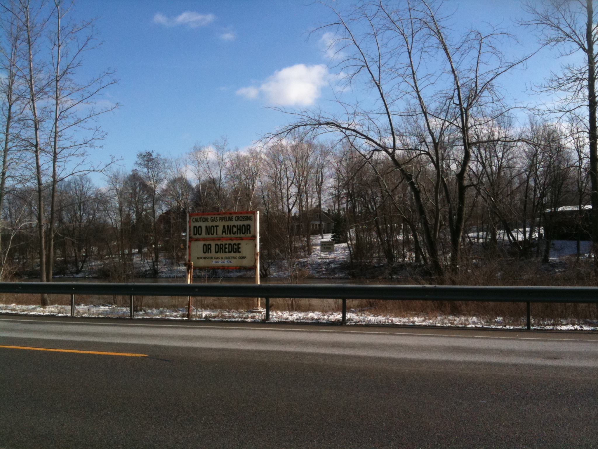
We have identified an RGE gas pipeline that runs from a hill on the West Side of RIT's campus (just South of the Red Barn) across East River Rd, across the river, across Scottsville Rd, and through cleared woods to the GVGreenway Trail.

This path has just the trajectory we might want in developing the RIT Tweenway, and the trees are already cleared.  (The path is not surfaced.)


View tweenway Spur in a larger map

Here are some panoramas
The view from the hill to the West: http://farm3.static.flickr.com/2721/4309845639_f1e422dcce_o.jpg


The view from Scottsville Rd East to RIT: http://farm5.static.flickr.com/4045/4309844619_70c0ddf04f_o.jpg


The view at the GVGreenway-Pipeline intersection (380 degrees) : http://farm3.static.flickr.com/2798/4338153998_0616943c66_o.jpg:


Let's call the path that might be made from the pipeline the "Tweenway Spur" (assuming the cross-RIT bike trail is to be called the RIT Tweenway.)

The ideal  long-range vision is for a cycle/pedestrian bridge from the hill on the RIT campus to the Tweenway Spur, without their having to touch down on the East River Rd, Scottsville Rd, or the River.

However, even without the Tweenway Bridge, this spur would provide a more intuitive, scenic and safer alternative route to the Ballantyne Bridge (and thence to  RIT or Jefferson Road and the Lehigh Valley North Trail).


Wednesday, January 27, 2010

Towpath Trail idea really floats


The newest segment of the Towpath Trail in South Akron includes a floating section that runs nearly a third of a mile along Summit Lake's southern shoreline and passes under the Kenmore Boulevard bridge.


http://www.ohio.com/lifestyle/ohio_travel/56239382.html

---------------------------------------------------------------------------------------------------------------
---------------------------------------------------------------------------------------------------------------
And then there's these: